🇮🇹Italy · Dolomites

Alta Via 4

Multi-day hut-to-hut trek across Alpenverein huts
Alta Via 4
Expert TraverseVia ferrata
Ilaria ch · CC BY-SA 4.0
100 km
Distance
+6,500 m
Ascent
6 days
Duration
0
Huts
Best time: July – September
Check hut availability →
Download GPX ↓

About the route

Highest point
2,405 m
Huts on the route
0 × hut
Secured sections
Via ferrata K3-K4
Best time
July – September

The route at a glance

Elevation profile
↑ 4,792 m ascent↓ 4,171 m descent71.4 km2,466 m summit
1000180025000 km14 km29 km43 km57 km71 km
Line colour = gradient (green gentle → red steep). Dots = huts. Route: © OpenStreetMap (ODbL), elevations from mapy.com.
Route mapOpen full map ↗

Plan and book

Live availability · Alpenverein

Pick a start date — for every night on the route you instantly see the free beds and book directly through the official Alpenverein system.


Choose start date
How many staying overnight
1
„free" = beds for the whole group
MonTueWedThuFriSatSun
All huts freePartly freeSelected
Start · arrival
San Candido
◎ Plan arrival
San Candido
Before the start · lodging
Stay overnight in San Candido
Hotels and guesthouses in San Candido · Booking.com
Booking.com →
1
Day 1 · traverse to Rifugio Tre Scarperi
↔ 8.4 km↑ 453 m◷ 3–4 h

Ascent from San Candido into the heart of the Sexten Dolomites to Rifugio Tre Scarperi (1,640 m). An easy opening before the wildness begins.

Rifugio Tre Scarperi 1640 m
Valley village · lodging via Booking.com
Booking.com →
2
Day 2 · traverse to Rifugio Locatelli
↔ 6.4 km↑ 841 m↓ 69 m◷ 3–4 h

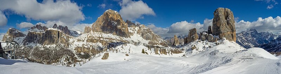
Sleep at Rifugio Locatelli (2,405 m) directly opposite the north faces of Tre Cime. The hut from 1882 is named after pilot Antonio Locatelli and stands by the World War I front line — preserved tunnels nearby.

Rifugio Locatelli 2405 m
Valley village · lodging via Booking.com
Booking.com →
3
Day 3 · traverse to Rifugio Fonda Savio
↔ 8.3 km↑ 466 m↓ 506 m◷ 3–4 h

Through the rock maze of Cadini di Misurina towers to Rifugio Fonda Savio — a rampart of slender pillars that look like stone organ pipes.

Rifugio Fonda Savio 2000 m
Valley village · lodging via Booking.com
Booking.com →
4
Day 4 · traverse to Rifugio Vandelli
↔ 13.1 km↑ 600 m↓ 1032 m◷ 6–7 h

Rifugio Vandelli sits in the Sorapis basin minutes from the turquoise lake Lago di Sorapis. This hut reopened in 1966 after burning down.

Rifugio Vandelli 2057 m
Valley village · lodging via Booking.com
Booking.com →
5
Day 5 · traverse to Rifugio San Marco
↔ 15.7 km↑ 1146 m↓ 1270 m◷ 8–9 h

Across the remote Marmarole group to Rifugio San Marco. Traffic dwindles, silence deepens — one of the quietest corners of the Dolomites.

Rifugio San Marco 1816 m
Valley village · lodging via Booking.com
Booking.com →
Descent to the valley · Val di Zoldo
From the last hut you descend to the valley village — approximate destination, lodging below.
Val di Zoldo
After the trek · lodging
Rest up in Val di Zoldo
Hotels and guesthouses in Val di Zoldo · Booking.com
Booking.com →
Route alert
Want the whole route on one date?
Leave your e-mail. We’ll write as soon as every hut on the route lines up with no gaps — with the dates straight to your calendar.

What to pack

Sleeping bag liner
Sleeping bag liner
Required in huts
Browse at 4camping →
Hiking boots
Hiking boots
Ankle-high, category B–C
Browse at 4camping →
Waterproof jacket
Waterproof jacket
Hardshell, 3-layer
Browse at 4camping →
Backpack 30–40 l
Backpack 30–40 l
Multi-day, with rain cover
Browse at 4camping →
Trekking poles
Trekking poles
Foldable
Browse at 4camping →
Headlamp
Headlamp
Rechargeable
Browse at 4camping →
Via ferrata set
Via ferrata set
Shock absorber + carabiners
Browse at 4camping →
Climbing helmet
Climbing helmet
Light, for via ferrata
Browse at 4camping →

Handy before you go

tips from verified partners
View on GetYourGuide
Partner · experiences
Tours and activities nearby
Guided tours, via ferratas and trips around San Candido — book online.
View on GetYourGuide →
Get Revolut
Partner · payments
No foreign-currency fees
A card for fee-free payments and withdrawals along the whole route — exchange rate with no markup.
Get Revolut →
Buy an eSIM on Airalo
Partner · connectivity
eSIM data in the Alps
Mobile data without roaming for the whole trek, activated in a minute.
Buy an eSIM on Airalo →

Frequently asked questions

How long is Alta Via 4 and how many days?+
Roughly 100 km over six stages, so six days on the route. It is the shortest of the Dolomite high routes, but kilometers here are measured more by meters of elevation gain and exposure than by distance.
How difficult is it?+
Rated EE — expert mountaineers only. North from San Candido via Tre Cime is manageable for a fit hiker, but the farther south, the wilder: exposed meadows beneath Antelao and a few sections with steel cable anchors. Do not come here without experience and a sure step.
How much elevation is gained?+
Around 6,500 m of climbing over six days. The highest point is around 2,600 m, and at the end in Pieve di Cadore you drop to 880 m.
Where does the route go — start and end?+
Starts in San Candido (Innichen) in the north and ends in Pozzale near Pieve di Cadore in the south. Along the way it crosses eight Dolomite mountain groups.
Which huts are along the route?+
Rifugio Tre Scarperi, Rifugio Locatelli, Rifugio Fonda Savio, Rifugio Vandelli, Rifugio San Marco, and Rifugio Antelao. Each stage ends at a hut.
Is there via ferrata on the route?+
Not proper via ferrata. But you will find sections with steel cable anchors and lots of exposure. The difficulty comes from remoteness and steep open terrain, not technical climbing.
When can you go — what is the season?+
Roughly mid-June through September when huts are open. July and August are ideal when passes are snow-free. Outside season it closes and high areas may hold firm.
How do I book huts?+
In advance, by email or phone directly at each hut, one stage at a time. They fill during season. Most rifugios belong to CAI (Italian alpine club) — CAI or Alpenverein membership means a discount on overnights.
Who is Alta Via 4 named after?+
Paul Grohmann, an Austrian alpinist who in the mid-19th century first climbed several Dolomite peaks including Cima Grande di Lavaredo, Cristallo, Sorapis, and Antelao. That is why it is also called Alta Via di Grohmann.
Will I see Tre Cime and lake Sorapis?+
Yes, both. Day two you pass beneath the north faces of Tre Cime di Lavaredo and sleep at Rifugio Locatelli directly opposite them. Day four you arrive at Rifugio Vandelli minutes from the turquoise lake Sorapis.
Is it suitable for beginners?+
No. This is a route for the experienced with a sure step, weather sense, and self-sufficiency for six days. Beginners should start with the gentler Alta Via 1.
What peaks and groups will I see?+
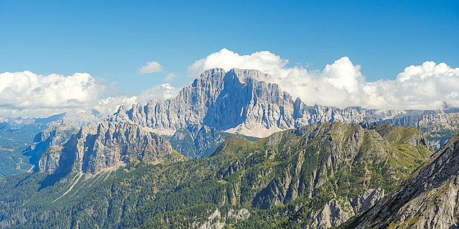
Tre Cime di Lavaredo, the Cadini di Misurina towers, the Sorapis massif, the remote Marmarole, and finally Antelao — the second-highest peak in the Dolomites.
Is it crowded?+
Less than the famous Alta Via 1. Alta Via 4 is among the quieter high routes — crowds mainly around Tre Cime itself; elsewhere silence prevails.

Similar routes

Show all routes →
Alta Via 1Moderate
Alta Via 1
Dolomites
140 km7-12 days
Dolomites High Trail 1Hard
Dolomites High Trail 1
Dolomites
150 km13 days
Meran High TrailModerate
Meran High Trail
South Tyrol
92 km5-8 days