🇦🇹Austria · Stubai Alps

Stubaier Höhenweg

Multi-day hut-to-hut trek across Alpenverein huts
Stubaier Höhenweg
Hard TraverseVia ferrata
The jackal100 · CC BY-SA 4.0
83 km
Distance
+6,200 m
Ascent
8 days
Duration
8
Huts
Best time: July – September
Check hut availability →
Download GPX ↓

About the route

Highest point
2,413 m
Huts on the route
8 × hut
Secured sections
Via ferrata K1 · avoidable
Best time
July – September

The route at a glance

Elevation profile
↑ 5,515 m ascent↓ 5,011 m descent72.4 km2,879 m summit
90019002900Starkenburger Hütte · 2237 mFranz-Senn-Hütte · 2289 mNeue Regensburger Hütte · 2286 mDresdner Hütte · 2287 mSulzenauhütte · 2191 mNürnberger Hütte · 2278 mBremer Hütte · 2413 mInnsbrucker Hütte · 2369 m0 km14 km29 km43 km58 km72 km
Line colour = gradient (green gentle → red steep). Dots = huts. Route: © OpenStreetMap (ODbL), elevations from mapy.com.
Route mapOpen full map ↗

Plan and book

Live availability · Alpenverein

Pick a start date — for every night on the route you instantly see the free beds and book directly through the official Alpenverein system.


Choose start date
How many staying overnight
1
„free" = beds for the whole group
MonTueWedThuFriSatSun
All huts freePartly freeSelected
Start · arrival
Neustift im Stubaital
◎ Plan arrival
Neustift im Stubaital
Before the start · lodging
Stay overnight in Neustift im Stubaital
Hotels and guesthouses in Neustift im Stubaital · Booking.com
Booking.com →
1
Starkenburger Hütte
Day 1 · traverse to Starkenburger Hütte
↔ 9.7 km↑ 1248 m↓ 871 m◷ 6–7 h

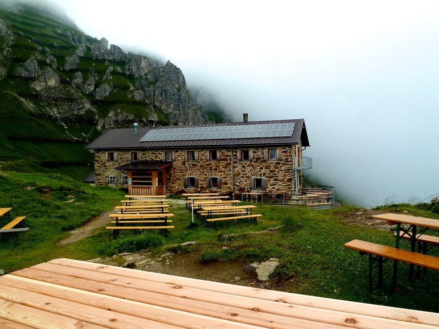
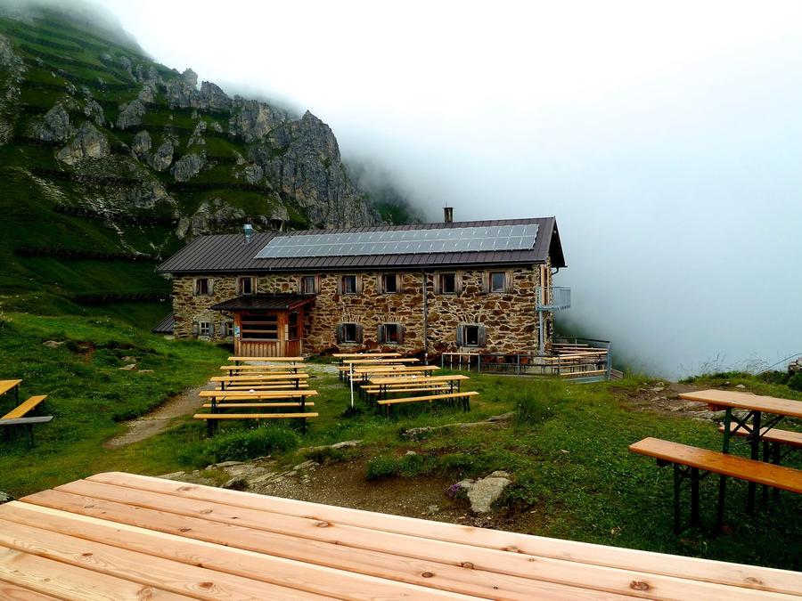
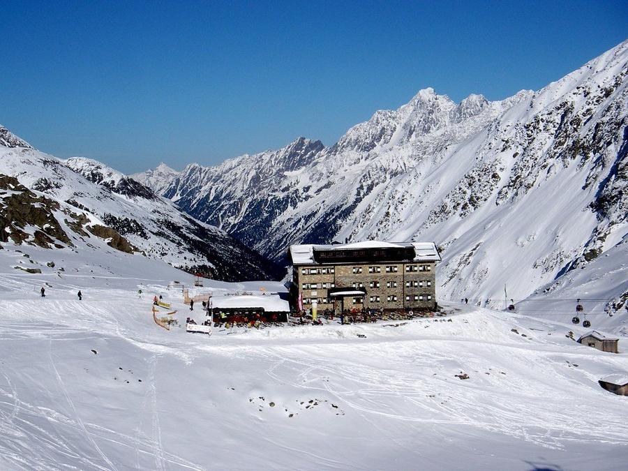
Climb from the valley to Starkenburger Hütte (2,237 m)—built in 1900 by the Starkenburg section of the German Alpenverein above Neustift.

2
Franz-Senn-Hütte
Day 2 · traverse to Franz-Senn-Hütte
↔ 15.5 km↑ 572 m↓ 664 m◷ 6–7 h

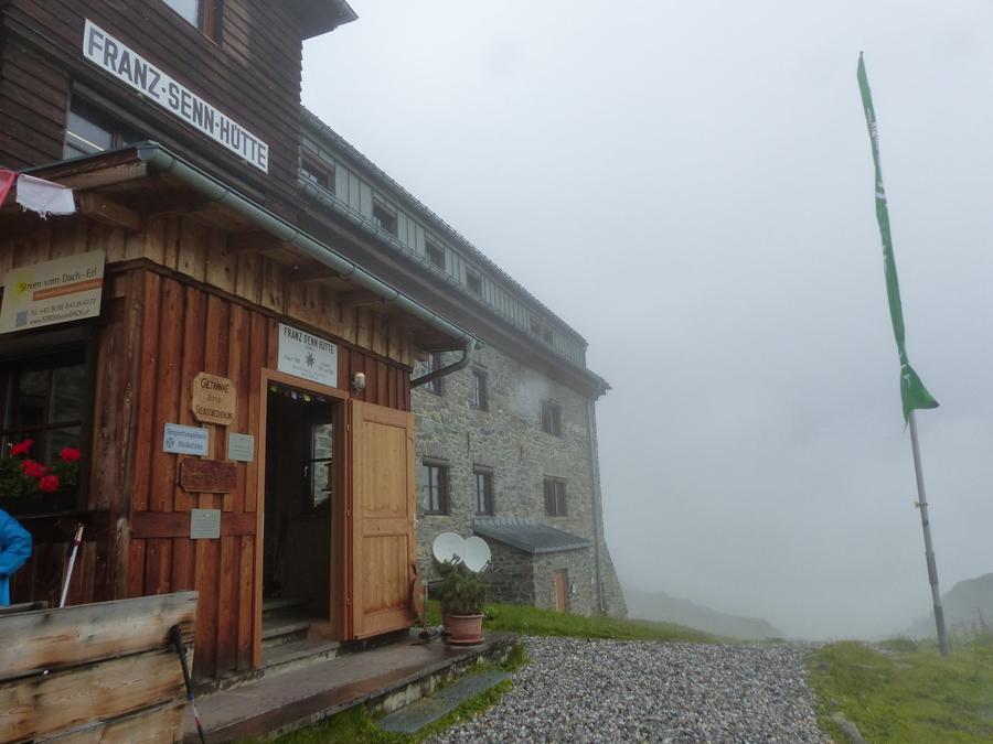
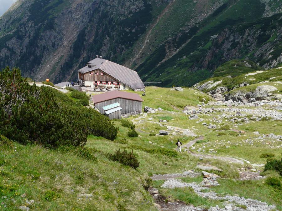
Traverse to Franz-Senn-Hütte (2,147 m), named after Priest and alpine pioneer Franz Senn. He started it in 1885 with twelve hay beds instead of mattresses; today it belongs to the ÖAV Innsbruck section.

3
Neue Regensburger Hütte
Day 3 · traverse to Neue Regensburger Hütte
↔ 9.2 km↑ 639 m↓ 500 m◷ 4–5 h

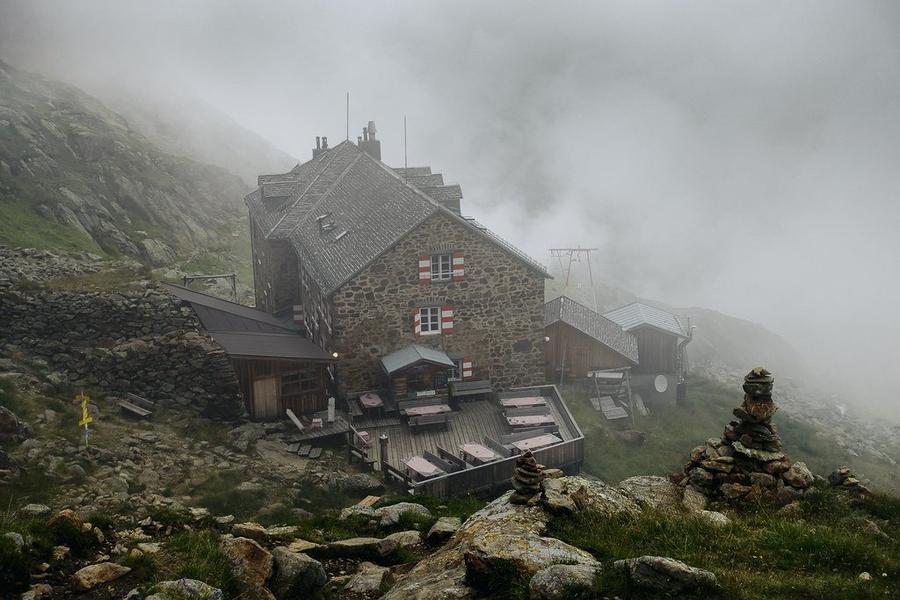
Shorter stage to Neue Regensburger Hütte (2,286 m) from 1930/31, with views of Ruderhofspitze and mighty Habicht.

4
Dresdner Hütte
Day 4 · traverse to Dresdner Hütte
↔ 12.4 km↑ 874 m↓ 852 m◷ 6–7 h

Challenging traverse to Dresdner Hütte (2,308 m), built by the Dresden section in 1887. Today it stands overlooking the Stubai glacier.

5
Sulzenauhütte
Day 5 · traverse to Sulzenauhütte
↔ 4.6 km↑ 423 m↓ 538 m◷ 2–3 h

Trail to Sulzenauhütte (2,191 m) passes turquoise glacial Blaue Lacke—a lake in a color you might assume is photo-edited.

Night 5
Hut info →Book →
6
Nürnberger Hütte
Day 6 · traverse to Nürnberger Hütte
↔ 4.6 km↑ 472 m↓ 387 m◷ 2–3 h

Traverse to Nürnberger Hütte (2,278 m), built in 1886 in glacial terrain. En route you pass Grünausee.

7
Bremer Hütte
Day 7 · traverse to Bremer Hütte
↔ 5.8 km↑ 600 m↓ 465 m◷ 3–4 h🪝 ferrata K1 · lze obejít

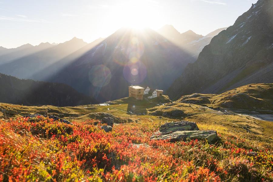
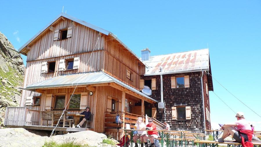
Stage reaching tiny, rustic Bremer Hütte (2,413 m), built by the Bremen section in 1897.

Night 7
Hut info →Book →
8
Innsbrucker Hütte
Day 8 · traverse to Innsbrucker Hütte
↔ 10.7 km↑ 687 m↓ 734 m◷ 5–6 h

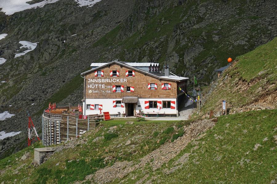
Finale at Innsbrucker Hütte (2,369 m) beneath Habicht (3,277 m)—one of the route's most demanding stages with three steep climbs in succession. The hut has been family-run by the Eggers and Hofers since 1949.

Descent to the valley · Neustift im Stubaital
The loop closes back at the starting village — approximate destination, lodging below.
Neustift im Stubaital
After the trek · lodging
Stay an extra day in Neustift im Stubaital
Hotels and guesthouses in Neustift im Stubaital · Booking.com
Booking.com →
Route alert
Want the whole route on one date?
Leave your e-mail. We’ll write as soon as every hut on the route lines up with no gaps — with the dates straight to your calendar.

What to pack

Sleeping bag liner
Sleeping bag liner
Required in huts
Browse at 4camping →
Hiking boots
Hiking boots
Ankle-high, category B–C
Browse at 4camping →
Waterproof jacket
Waterproof jacket
Hardshell, 3-layer
Browse at 4camping →
Backpack 30–40 l
Backpack 30–40 l
Multi-day, with rain cover
Browse at 4camping →
Trekking poles
Trekking poles
Foldable
Browse at 4camping →
Headlamp
Headlamp
Rechargeable
Browse at 4camping →
Via ferrata set
Via ferrata set
Shock absorber + carabiners
Browse at 4camping →
Climbing helmet
Climbing helmet
Light, for via ferrata
Browse at 4camping →

Handy before you go

tips from verified partners
View on GetYourGuide
Partner · experiences
Tours and activities nearby
Guided tours, via ferratas and trips around Neustift im Stubaital — book online.
View on GetYourGuide →
Get Revolut
Partner · payments
No foreign-currency fees
A card for fee-free payments and withdrawals along the whole route — exchange rate with no markup.
Get Revolut →
Buy an eSIM on Airalo
Partner · connectivity
eSIM data in the Alps
Mobile data without roaming for the whole trek, activated in a minute.
Buy an eSIM on Airalo →

Frequently asked questions

How long is Stubaier Höhenweg and how much elevation does it have?+
The circuit measures roughly 83 km with around 6,200 meters of elevation. It typically takes 7 stages / 8 days with stays at eight huts, plus approach and descent days from Neustift.
How difficult is Stubaier Höhenweg?+
Challenging high alpine traverse. Narrow, steep trails, scree, boulder fields, several rope-secured sections with steel cables and ladders. Requires a sure foot, resistance to altitude, and strong fitness for eight-hour daily stages.
Which huts do you sleep in on the route?+
In sequence: Starkenburger Hütte, Franz-Senn-Hütte, Neue Regensburger Hütte, Dresdner Hütte, Sulzenauhütte, Nürnberger Hütte, Bremer Hütte, and Innsbrucker Hütte. All belong to Alpenverein sections (ÖAV/DAV).
Where does the route start and end?+
It is a circuit—both starting and ending in Neustift in the Stubaital (Tyrol, Austria). No need to arrange return transportation from the finish.
Is there via ferrata on Stubaier Höhenweg?+
No classic via ferrata, but several stages have rope-secured sections with steel cables and ladders, particularly in the second half. A formal via ferrata kit is not typically needed; sure-footedness in exposed terrain is essential.
When is the best time to go?+
July through September. The route opens by late June, but snow often lingers on passes until mid-June and rope sections can be iced—wait for full summer conditions.
How do I book huts?+
Contact each hut directly—they belong to ÖAV and DAV sections. Half-board is recommended, and advance booking is essential, especially in August. Alpenverein membership lowers bed rates and includes rescue insurance.
Which peaks and lakes will I see?+
Highest is Zuckerhütl (3,507 m), highest peak of the Stubai Alps, plus Wilder Freiger (3,418 m) and Habicht (3,277 m). Lakes include turquoise Blaue Lacke near Sulzenauhütte and Grünausee before Nürnberger Hütte.
Which stage is most difficult?+
The final stage to Innsbrucker Hütte beneath Habicht ranks among the toughest—three steep climbs in succession before the hut.
Is Stubaier Höhenweg suitable for beginners?+
No. It is a trek for seasoned hikers with multiday mountain experience. For first hut-to-hut attempts, young children, or anyone uncomfortable with exposure, it is not suitable.
Do I need a mountain guide?+
For experienced and confident hikers, the route is marked and manageable without a guide. Those unsure on exposed terrain or expecting residual snow may benefit from a guide or group.

Similar routes

Show all routes →
Berliner HöhenwegHard
Berliner Höhenweg
Zillertal Alps
90 km8-9 days
Schladminger Tauern HöhenwegModerate
Schladminger Tauern Höhenweg
Low Tauern
76 km5-7 days
Carnic High TrailHard
Carnic High Trail
Carnic Alps
156 km8-11 days