🇮🇹Italy · South Tyrol

Meran High Trail

Multi-day hut-to-hut trek across Alpenverein huts
Meran High Trail
Moderate Traverse
Triplec85 · CC0
92 km
Distance
+5,100 m
Ascent
5-8 days
Duration
1
Hut
Best time: July – September
Check hut availability →
Download GPX ↓

About the route

Highest point
2,875 m
Huts on the route
1 × hut
Terrain
High alpine
Best time
July – September

The route at a glance

Elevation profile
↑ 4,624 m ascent↓ 4,624 m descent91.8 km2,890 m summit
700180029000 km18 km37 km55 km73 km92 km
Line colour = gradient (green gentle → red steep). Dots = huts. Route: © OpenStreetMap (ODbL), elevations from mapy.com.
Route mapOpen full map ↗

Plan and book

Live availability · Alpenverein

Pick a start date — for every night on the route you instantly see the free beds and book directly through the official Alpenverein system.


Choose start date
How many staying overnight
1
„free" = beds for the whole group
MonTueWedThuFriSatSun
All huts freePartly freeSelected
Start · arrival
Merano
◎ Plan arrival
Merano
Before the start · lodging
Stay overnight in Merano
Hotels and guesthouses in Merano · Booking.com
Booking.com →
1
Day 1 · traverse to Gasthof Giggelberg

Start above Partschins at Gasthof Giggelberg, reached by Texelbahn cable car. Right away the famous 1000 Stufen Schlucht — 987 steps and a suspension bridge over a waterfall since 2017.

Gasthof Giggelberg 2000 m
Valley village · lodging via Booking.com
Booking.com →
2
Day 2 · traverse to Katharinaberg Hütte

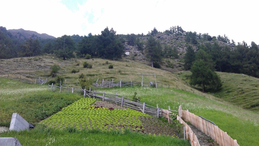
Balcony path across alpine meadows above the valley, with gradual climbing into the high alpine north section toward Katharinaberg.

Katharinaberg Hütte 2170 m
Valley village · lodging via Booking.com
Booking.com →
3
Day 3 · traverse to Eishof

The wildest corner of the circuit. Eishof was until the late 19th century the highest permanently inhabited settlement in old Tyrol, first documented in the 13th century.

Eishof 2074 m
Valley village · lodging via Booking.com
Booking.com →
4
Day 4 · traverse to Stettiner Hütte

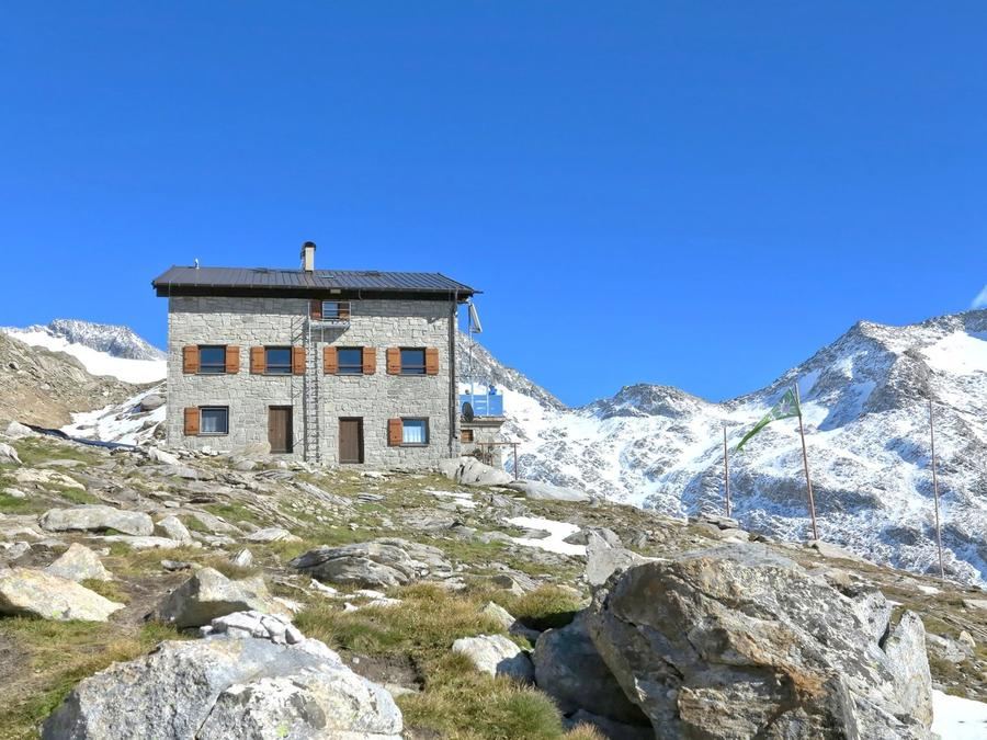
Summit day over Eisjöchl pass (2,895 m), the circuit's crown. Stettiner Hütte (2,875 m) below it was swept away by avalanche in February 2014; the new, modern hut has stood since 2022.

Stettiner Hütte 2875 m
Valley village · lodging via Booking.com
Booking.com →
Descent to the valley · Merano
The loop closes back at the starting village — approximate destination, lodging below.
Merano
After the trek · lodging
Stay an extra day in Merano
Hotels and guesthouses in Merano · Booking.com
Booking.com →
Route alert
Want the whole route on one date?
Leave your e-mail. We’ll write as soon as every hut on the route lines up with no gaps — with the dates straight to your calendar.

What to pack

Sleeping bag liner
Sleeping bag liner
Required in huts
Browse at 4camping →
Hiking boots
Hiking boots
Ankle-high, category B–C
Browse at 4camping →
Waterproof jacket
Waterproof jacket
Hardshell, 3-layer
Browse at 4camping →
Backpack 30–40 l
Backpack 30–40 l
Multi-day, with rain cover
Browse at 4camping →
Trekking poles
Trekking poles
Foldable
Browse at 4camping →
Headlamp
Headlamp
Rechargeable
Browse at 4camping →
Layered clothing
Layered clothing
Merino + fleece
Browse at 4camping →
First-aid kit
First-aid kit
+ emergency blanket
Browse at 4camping →

Handy before you go

tips from verified partners
View on GetYourGuide
Partner · experiences
Tours and activities nearby
Guided tours, via ferratas and trips around Merano — book online.
View on GetYourGuide →
Get Revolut
Partner · payments
No foreign-currency fees
A card for fee-free payments and withdrawals along the whole route — exchange rate with no markup.
Get Revolut →
Buy an eSIM on Airalo
Partner · connectivity
eSIM data in the Alps
Mobile data without roaming for the whole trek, activated in a minute.
Buy an eSIM on Airalo →

Frequently asked questions

How long is Meraner Höhenweg?+
A circuit around the Texelgruppe massif, roughly 100 km total with about 5,100 m of climbing. You do not cross the range — you circle it, returning to where you started.
How many days does the route take?+
Five to eight days depending on pace and preference. Those with strong legs and who want shorter days can do it in five; those wanting more leisure spread it over seven or eight.
How difficult is the route?+
Moderately demanding with two characters. The north section is high alpine and exposed, with the Eisjöchl pass (2,895 m) summit — needs fitness and a sure step. The south balcony is notably gentler.
Which huts and farmsteads are on the route?+
Among them Gasthof Giggelberg, Katharinaberg, the mountain farmstead Eishof, Stettiner Hütte below Eisjöchl, and the south side. The route connects mountain huts and old farmsteads, "from farmstead to farmstead."
What is the highest point?+
Eisjöchl pass at 2,895 m on the north half of the circuit. Stettiner Hütte sits just below at 2,875 m. It is the summit day of the entire trek.
When is the best season?+
For the full circuit July through September when high sections are snow-free and Stettiner Hütte open. The gentle south balcony can be walked much longer, spring through autumn.
Is there via ferrata on the route?+
Classic secured via ferrata it is not. The north section over Eisjöchl is high alpine and locally exposed though, so a firm step and nerve for steep passages help.
How do I book overnight stays?+
Book beds in advance, especially at exposed spots like Stettiner Hütte and Eishof, where capacity is limited and August is full. Most places belong to Alpenverein or private operators; Alpenverein membership (AVS, ÖAV, DAV) brings a discount and better booking access.
Do I have to do the full circuit?+
No. The route can be split — the gentle sunny balcony above the Etsch valley is mild and doable even for less experienced hikers. Save the demanding north section over Eisjöchl for another trip.
What is the 1000 Stufen Schlucht?+
A famous gorge right at the start above Partschins. The name promises a thousand steps and delivers 987, with a suspension bridge over a waterfall since 2017.
Is the route family-friendly?+
The south balcony half, yes — it runs in lower elevations above the valley and is gentle. The high alpine north half with exposure and the Eisjöchl pass should be for the fitter group.
Where do I start the circuit?+
You can start from multiple points. Common starts are Hochmuth above Dorf Tirol and Giggelberg above Partschins — both are reached by cable car, so you skip the initial grind up from the valley.

Similar routes

Show all routes →
Pfunderer High TrailHard
Pfunderer High Trail
South Tyrol
70 km5-6 days
South Tyrol TraverseHard
South Tyrol Traverse
South Tyrol
45 km2-3 days
Alta Via 1Moderate
Alta Via 1
Dolomites
140 km7-12 days