🇦🇹Austria · Zillertal Alps

Berliner Höhenweg

Multi-day hut-to-hut trek across Alpenverein huts
Berliner Höhenweg
Hard TraverseVia ferrata
Thoryc · CC BY-SA 4.0
90 km
Distance
+7,000 m
Ascent
8-9 days
Duration
7
Huts
Best time: July – September
Check hut availability →
Download GPX ↓

About the route

Highest point
2,485 m
Huts on the route
7 × hut
Secured sections
Via ferrata K2 · avoidable
Best time
July – September

The route at a glance

Elevation profile
↑ 7,158 m ascent↓ 7,849 m descent105.5 km3,115 m summit
60019003200Gamshütte · 1758 mFriesenberghaus · 2485 mFurtschaglhaus · 2298 mBerliner Hütte · 2042 mGreizer Hütte · 1906 mKasseler Hütte (im Zillertal) · 2218 mKarl-von-Edel-Hütte · 1554 m0 km21 km42 km63 km84 km106 km
Line colour = gradient (green gentle → red steep). Dots = huts. Route: © OpenStreetMap (ODbL), elevations from mapy.com.
Route mapOpen full map ↗

Plan and book

Live availability · Alpenverein

Pick a start date — for every night on the route you instantly see the free beds and book directly through the official Alpenverein system.


Choose start date
How many staying overnight
1
„free" = beds for the whole group
MonTueWedThuFriSatSun
All huts freePartly freeSelected
Start · arrival
Finkenberg
◎ Plan arrival
Finkenberg
Before the start · lodging
Stay overnight in Finkenberg
Hotels and guesthouses in Finkenberg · Booking.com
Booking.com →
1
Gamshütte
Day 1 · traverse to Gamshütte
↔ 14.9 km↑ 987 m↓ 392 m◷ 6–7 h

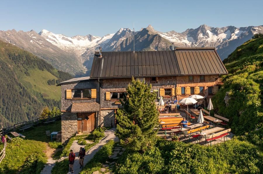
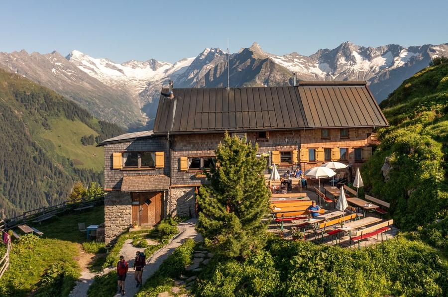
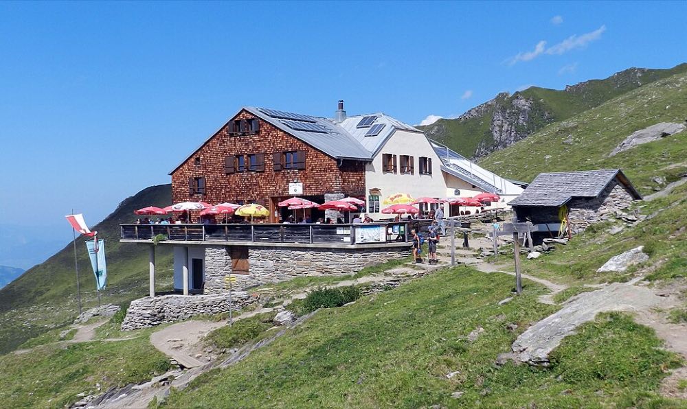
Climb from the valley to Gamshütte (1,921 m) with views across the entire Zillertal. This is the route's youngest section—the link from Friesenberghaus to Gamshütte wasn't completed until 1976 after eight years of work in demanding terrain.

Gamshütte 1758 m
Night 1
Hut info →Book →
2
Friesenberghaus
Day 2 · traverse to Friesenberghaus
↔ 14.8 km↑ 1098 m↓ 543 m◷ 7–8 h

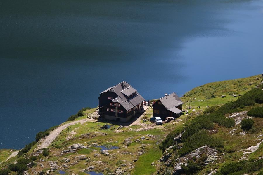
Long high alpine stage to Friesenberghaus (2,498 m) above turquoise Friesenbergsee. Built between 1927–1931 by the Donauland section as a symbol of tolerance; views of Hoher Riffler and Olperer.

3
Furtschaglhaus
Day 3 · traverse to Furtschaglhaus
↔ 13.9 km↑ 521 m↓ 707 m◷ 5–6 h

Traverse to Furtschaglhaus (2,295 m), the base camp before the route's most demanding stage.

Night 3
Hut info →Book →
4
Berliner Hütte
Day 4 · traverse to Berliner Hütte
↔ 8.5 km↑ 907 m↓ 1161 m◷ 5–6 h

The royal stage: over Schönbichler Horn (3,134 m), the highest and technically most challenging point, on granite slabs secured by fixed ropes. Hochfeiler, Großer Möseler, and Schwarzenstein glaciers crown the summit. Berliner Hütte awaits below.

5
Greizer Hütte
Day 5 · traverse to Greizer Hütte
↔ 10.8 km↑ 1190 m↓ 1000 m◷ 6–7 h

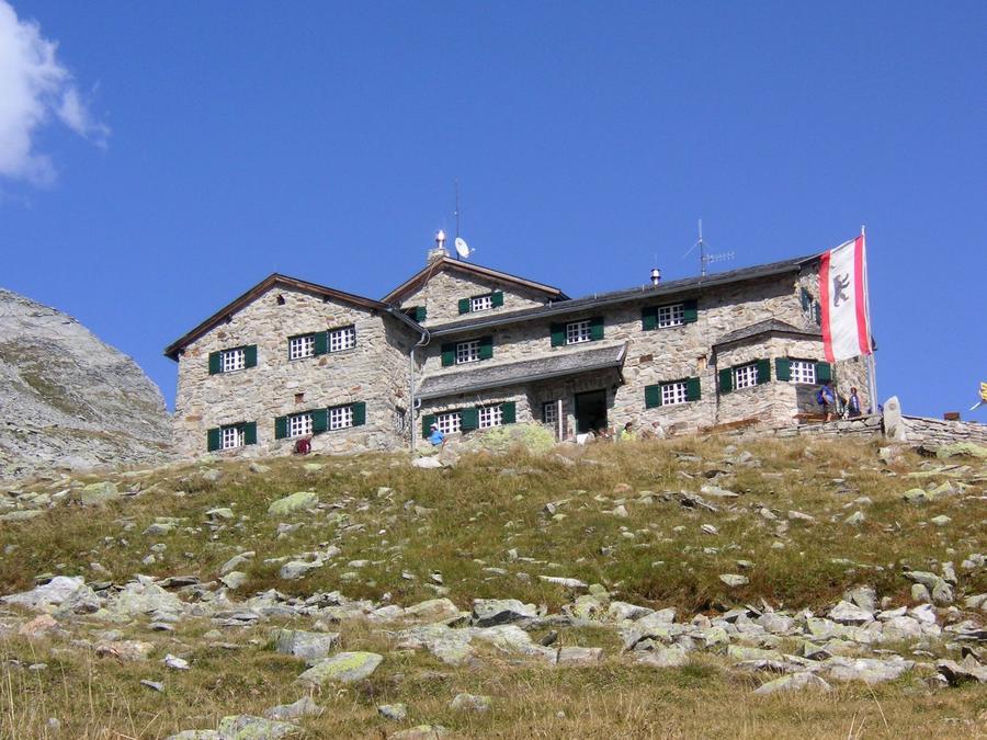
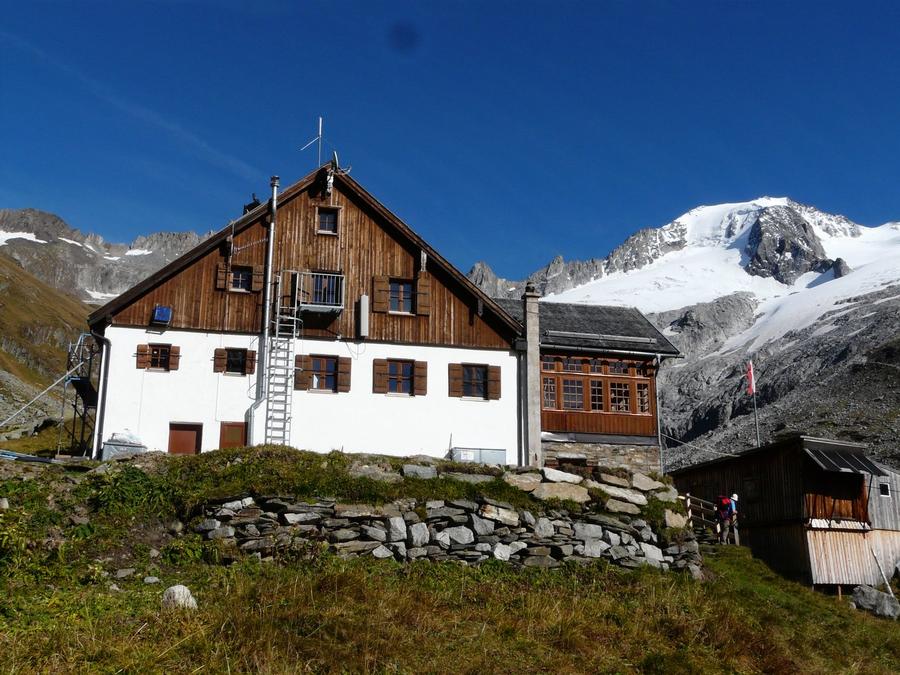
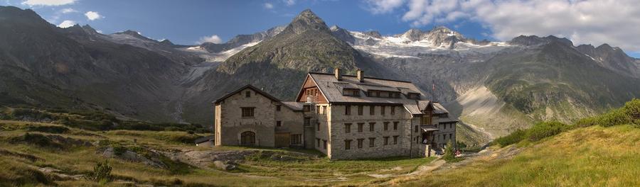
Berliner Hütte (2,042 m)—the Zillertal's oldest hut (1879) and Austria's only mountain hut protected as a national monument. From here, descent and traverse to Greizer Hütte across alpine meadows.

Night 5
Hut info →Book →
6
Kasseler Hütte (im Zillertal)
Day 6 · traverse to Kasseler Hütte (im Zillertal)
↔ 5.3 km↑ 855 m↓ 430 m◷ 3–4 h

Climb to Kasseler Hütte (2,177 m) with views of the surrounding Zillertal Alps peaks.

7
Karl-von-Edel-Hütte
Day 7 · traverse to Karl-von-Edel-Hütte
↔ 29.1 km↑ 1593 m↓ 2010 m◷ 13–14 h

The final hut on the ridge: Karl-von-Edel-Hütte (Edelhütte, 2,238 m) high above Mayrhofen with sight of Ahornspitze.

Descent to the valley · Finkenberg
The loop closes back at the starting village — approximate destination, lodging below.
Finkenberg
After the trek · lodging
Stay an extra day in Finkenberg
Hotels and guesthouses in Finkenberg · Booking.com
Booking.com →
Route alert
Want the whole route on one date?
Leave your e-mail. We’ll write as soon as every hut on the route lines up with no gaps — with the dates straight to your calendar.

What to pack

Sleeping bag liner
Sleeping bag liner
Required in huts
Browse at 4camping →
Hiking boots
Hiking boots
Ankle-high, category B–C
Browse at 4camping →
Waterproof jacket
Waterproof jacket
Hardshell, 3-layer
Browse at 4camping →
Backpack 30–40 l
Backpack 30–40 l
Multi-day, with rain cover
Browse at 4camping →
Trekking poles
Trekking poles
Foldable
Browse at 4camping →
Headlamp
Headlamp
Rechargeable
Browse at 4camping →
Via ferrata set
Via ferrata set
Shock absorber + carabiners
Browse at 4camping →
Climbing helmet
Climbing helmet
Light, for via ferrata
Browse at 4camping →

Handy before you go

tips from verified partners
View on GetYourGuide
Partner · experiences
Tours and activities nearby
Guided tours, via ferratas and trips around Finkenberg — book online.
View on GetYourGuide →
Get Revolut
Partner · payments
No foreign-currency fees
A card for fee-free payments and withdrawals along the whole route — exchange rate with no markup.
Get Revolut →
Buy an eSIM on Airalo
Partner · connectivity
eSIM data in the Alps
Mobile data without roaming for the whole trek, activated in a minute.
Buy an eSIM on Airalo →

Frequently asked questions

How many days does the Berliner Höhenweg take?+
Typically 8 to 9 days—seven nights in huts plus a final descent to Mayrhofen. Daily stages last roughly 6 to 9 hours. Those who prefer a slower pace or wait for weather can add extra days.
How difficult is the Berliner Höhenweg?+
Demanding. It is a high alpine ridge trek requiring a sure foot, fitness for consecutive multi-day hiking, and a head that won't spin in exposed, roped terrain. Not a route for your very first multiday trek.
How much elevation gain and how long is the route?+
Around 7,000 meters of elevation gain over the entire circuit; total length ranges roughly 70–90 km depending on routing and rest days. You stay above 2,000 meters for almost the entire trek.
What is the route's highest point?+
Schönbichler Horn at 3,134 meters. It lies on the stage from Furtschaglhaus to Berliner Hütte and is also the most difficult section—the final meters cross granite slabs on fixed ropes.
Which huts are on the route?+
Gamshütte, Friesenberghaus, Furtschaglhaus, Berliner Hütte, Greizer Hütte, Kasseler Hütte, and Karl-von-Edel-Hütte (Edelhütte). Seven huts and a day-eight descent to Mayrhofen. Olpererhütte is sometimes included as a variant.
How do I book accommodation at the huts?+
Huts belong to Alpenverein sections (DAV/ÖAV). During peak season they fill weeks ahead, so reserve beds in advance—through the Alpenverein's booking system or directly on each hut's website. Membership means both lower prices and priority reservation.
When is the best time to go?+
From late June to late September roughly. The most reliable window is July and August when all huts operate and snowfields below Schönbichler Horn are passable. In June and September, expect residual snow at altitude.
Are there via ferrata or fixed rope sections?+
No continuous via ferrata, but several sections are rope-secured—most prominently on the ascent to Schönbichler Horn over granite slabs. A sure step and composure above exposed terrain are essential.
Where does the route start and end?+
It is a circuit in the Mayrhofen and Finkenberg area of the Zillertal Alps. It starts with a climb to Gamshütte and ends descending from Edelhütte to Mayrhofen, where you can easily return via cable cars and valley buses.
What makes Berliner Hütte famous?+
It is the Zillertal's oldest hut (opened 1879) and Austria's only mountain hut protected as a historical monument. Built by the Berlin section of the Alpenverein, you will find an impressive Art Nouveau dining hall inside—the high point of the entire trek.
Why is the route called Berliner Höhenweg?+
After the Berlin section of the German-Austrian Alpenverein, which built numerous huts and connecting trails in the Zillertal during the second half of the 19th century. Berliner Hütte from 1879 gave its name to the entire circuit.
Do I need climbing gear?+
Standard high alpine trekking equipment: solid boots with good grip, poles, layers for cold and wind, helmet for rocky sections. Ice axe and crampons usually not needed, but verify with the huts regarding any residual snow.
Who should not do this route?+
Not for beginners without experience on multiday treks, not for those with fear of heights, and not for anyone unable to walk 6 to 9 hours for consecutive days. The terrain above 2,000 meters shows no mercy.

Similar routes

Show all routes →
Zillertal Hut TraverseHard
Zillertal Hut Traverse
Zillertal Alps
83 km5 days
Stubaier HöhenwegHard
Stubaier Höhenweg
Stubai Alps
83 km8 days
Schladminger Tauern HöhenwegModerate
Schladminger Tauern Höhenweg
Low Tauern
76 km5-7 days