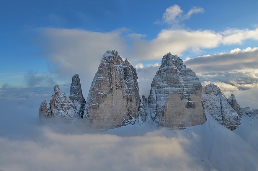
Stand on the Rifugio Locatelli terrace at dawn and you have it right before your nose. Three rock towers. North faces dropping nearly a kilometre into empty air. And the first sun igniting them from above like candles. Tre Cime di Lavaredo, Drei Zinnen, literally 'three battlements'. The Dolomites' most photographed rock. Except this time you won't sleep one night and shoot from one angle. This time you'll circle it completely.
The circuit around Tre Cime is a multi-day trek beginning and ending in Val Fiscalina (German: Fischleintal) in the Sexten Dolomites. Four days, roughly 45 km and around 3,800 metres of accumulated climbing. This isn't a Sunday cable-car walk, it's a demanding route ('hard' difficulty) where each day drags you over another saddle and your calves pay the price. But no climbing. This circuit demands no via ferrata, even though you could pack one voluntarily.
Terrain is pure Dolomite classic: broad scree valleys, dwarf pine, mountain tarns and above them vertical towers, cut as if with scissors. Day one leads up the Val Sasso Vecchio valley past the Laghi dei Piani lakes towards Rifugio Locatelli (2,405 m), a hut standing directly opposite the north faces. Built in 1882, rebuilt after the First World War in 1923, it's named after Italian pilot Antonio Locatelli. From here you view the three peaks like from a theatre box: Cima Grande (2,999 m) in the centre, Cima Ovest (2,973 m) and Cima Piccola (2,857 m).
Day two is the route's scenic jewel, the famous loop around the Tre Cime themselves via Forcella Lavaredo saddle, past Rifugio Lavaredo and Rifugio Auronzo. This is the Dolomites' most-walked circuit, and there's a reason. These north faces aren't just pretty in photos. They're legends of world climbing: Emilio Comici made the first ascent of Cima Grande's north face in 1933, three days and two nights on sheer rock. From the loop you can detour to the viewpoint over Cadini di Misurina, the second-most iconic Dolomite shot.
And then there's the war. The WWI front line between Italy and Austria-Hungary ran right here, between the towers. Remnants of the 'White War' from 1915–1917 remain: trenches, caverns and tunnels, mostly on nearby Monte Paterno, nowadays crossed by an armed trail. Sleep higher, in Büllelejochhütte (2,528 m), and you're in the Sexten Dolomites' highest hut. The final day sees Val Fiscalina Alta release you back down past Rifugio Zsigmondy-Comici, a kilometre of descent and the towers slowly close behind you.
Who is this for? For a fit hiker who can manage four days in succession and accumulated metres, but who doesn't want to hang from steel. Those seeking one of Europe's most famous rock backdrops from all angles, not just a car park. When to go? Huts open late June and close mid- to late September, outside season, snow lies and overnight stays aren't possible. Best light on the north faces comes early morning and late afternoon, which is precisely why you sleep there.
How to work it: book each hut separately and happily months in advance, Rifugio Locatelli and others fill fast in high season. Sort reservations direct through the huts or via Alpenverein's system; membership usually means a hut discount. Tre Cime isn't rock you'll circle in an afternoon and check off. They're four sunrises over three towers. And each one lights them differently.
Pick a start date, for every night on the route you instantly see the free beds and book directly through the official Alpenverein system.




 AT
AT DE
DE CH
CH EN
EN FR
FR IT
IT NL
NL SL
SL SK
SK CZ
CZ