🇨🇭Switzerland · Silvretta

Silvretta Traverse

Multi-day hut-to-hut trek across Alpenverein huts
Silvretta Traverse
Hard Cross-borderVia ferrata
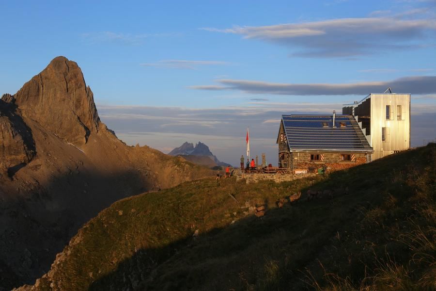
Kurz89 · CC BY-SA 4.0
65 km
Distance
+5,000 m
Ascent
5 days
Duration
5
Huts
Best time: July – September
Check hut availability →
Download GPX ↓

About the route

Highest point
Huts on the route
5 × hut
Secured sections
Via ferrata K1 · avoidable
Best time
July – September

The route at a glance

Elevation profile
↑ 3,419 m ascent↓ 4,019 m descent54.2 km2,976 m summit
190025003000Tübinger Hütte · 2193 mSaarbrücker Hütte · 2538 mWiesbadener Hütte · 2443 mJamtalhütte · 2165 mHeidelberger Hütte · 2364 m0 km11 km22 km33 km43 km54 km
Line colour = gradient (green gentle → red steep). Dots = huts. Route: © OpenStreetMap (ODbL), elevations from mapy.com.
Route mapOpen full map ↗

Plan and book

Live availability · Alpenverein

Pick a start date — for every night on the route you instantly see the free beds and book directly through the official Alpenverein system.


Choose start date
How many staying overnight
1
„free" = beds for the whole group
MonTueWedThuFriSatSun
All huts freePartly freeSelected
Start · arrival
Gaschurn
◎ Plan arrival
Gaschurn
Before the start · lodging
Stay overnight in Gaschurn
Hotels and guesthouses in Gaschurn · Booking.com
Booking.com →
1
Tübinger Hütte
Day 1 · traverse to Tübinger Hütte
↔ 19.9 km↑ 658 m↓ 1328 m◷ 8–9 h

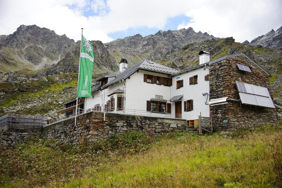
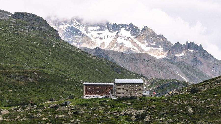
Ascent from Partenen to Tübinger Hütte (2191 m). The hut is run by Tübingen section — the first of four huts on the route named after German cities.

2
Saarbrücker Hütte
Day 2 · traverse to Saarbrücker Hütte
↔ 4.7 km↑ 742 m↓ 399 m◷ 3–4 h

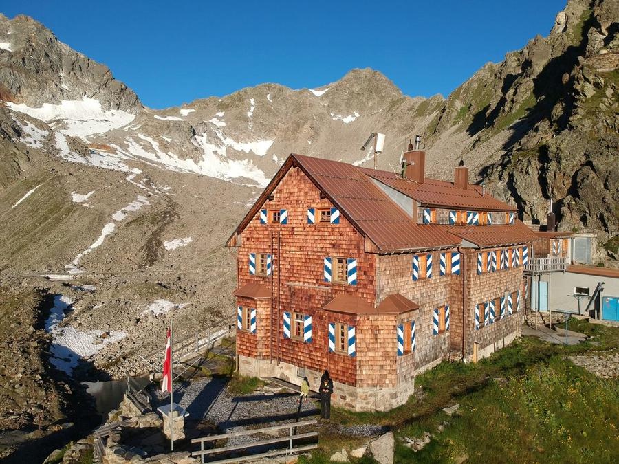
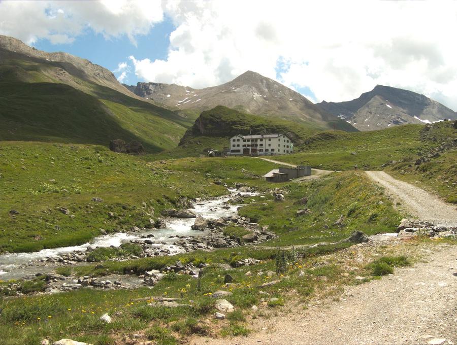
Traverse to Saarbrücker Hütte (2538 m), the trek's highest camp. From here you're a stone's throw from the high passes into the Silvretta heartland.

3
Wiesbadener Hütte
Day 3 · traverse to Wiesbadener Hütte
↔ 10.8 km↑ 670 m↓ 760 m◷ 5–6 h

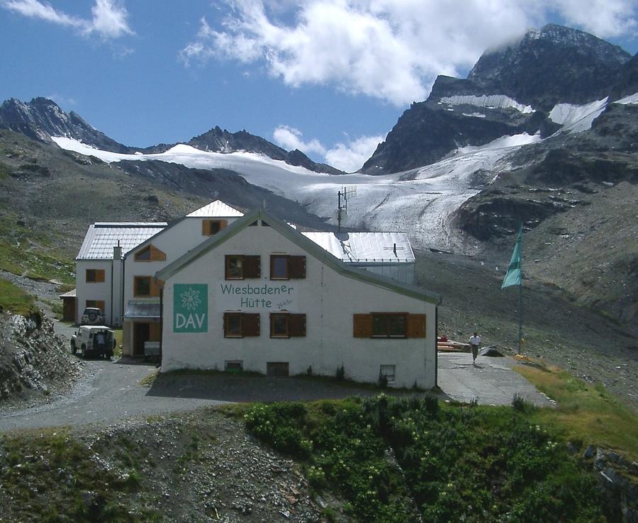
Wiesbadener Hütte (2443 m) sits at the end of Ochsentalein beneath Piz Buin itself, between Silvrettahorn (3244 m) and Dreiländerspitze (3197 m). Those with gear and experience can push up Ochsentaler Gletscher — two to three hours to the summit.

4
Jamtalhütte
Day 4 · traverse to Jamtalhütte
↔ 7.7 km↑ 536 m↓ 818 m◷ 4–5 h

Descent into Jamtal to Jamtalhütte (2165 m), about ten kilometres above Galtür. The hut is among the oldest in Silvretta, its history spanning over 140 years.

Night 4
Hut info →Book →
5
Heidelberger Hütte
Day 5 · traverse to Heidelberger Hütte
↔ 11.1 km↑ 813 m↓ 714 m◷ 5–6 h

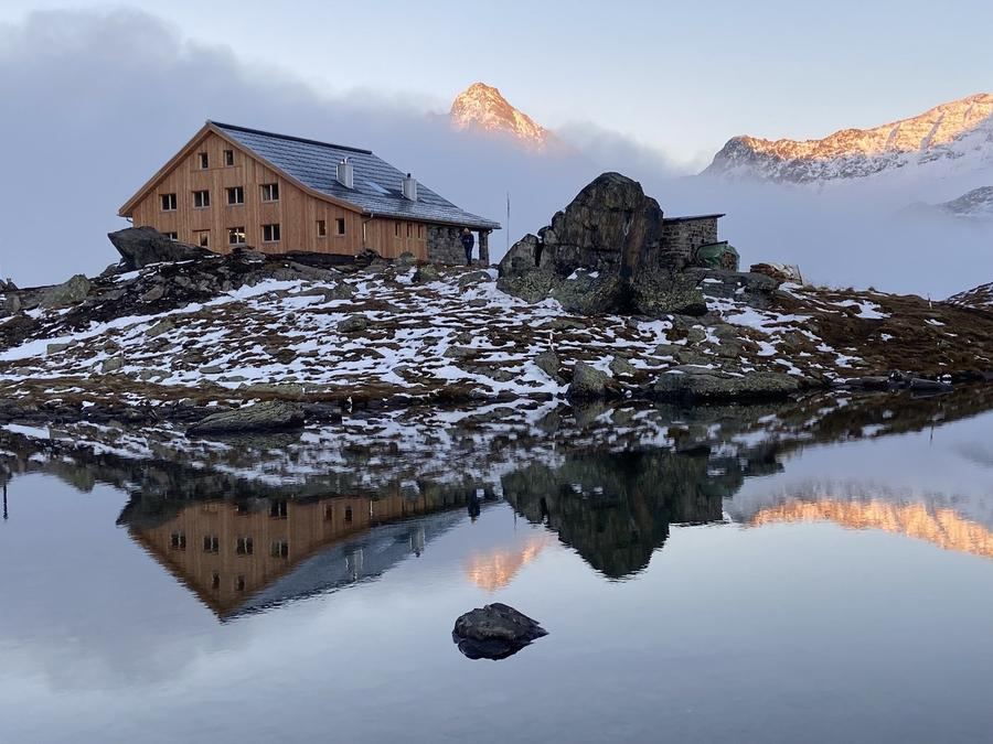
Last night at Heidelberger Hütte (2264 m) in Fimbertal (Val Fenga). It stands on Swiss soil in Graubünden but is supplied from Austrian Ischgl. Fluchthorn rises above it, its south summit having collapsed in a massive rockfall in 2023.

Descent to the valley · Gaschurn
The loop closes back at the starting village — approximate destination, lodging below.
Gaschurn
After the trek · lodging
Stay an extra day in Gaschurn
Hotels and guesthouses in Gaschurn · Booking.com
Booking.com →
Route alert
Want the whole route on one date?
Leave your e-mail. We’ll write as soon as every hut on the route lines up with no gaps — with the dates straight to your calendar.

What to pack

Sleeping bag liner
Sleeping bag liner
Required in huts
Browse at 4camping →
Hiking boots
Hiking boots
Ankle-high, category B–C
Browse at 4camping →
Waterproof jacket
Waterproof jacket
Hardshell, 3-layer
Browse at 4camping →
Backpack 30–40 l
Backpack 30–40 l
Multi-day, with rain cover
Browse at 4camping →
Trekking poles
Trekking poles
Foldable
Browse at 4camping →
Headlamp
Headlamp
Rechargeable
Browse at 4camping →
Via ferrata set
Via ferrata set
Shock absorber + carabiners
Browse at 4camping →
Climbing helmet
Climbing helmet
Light, for via ferrata
Browse at 4camping →

Handy before you go

tips from verified partners
View on GetYourGuide
Partner · experiences
Tours and activities nearby
Guided tours, via ferratas and trips around Gaschurn — book online.
View on GetYourGuide →
Get Revolut
Partner · payments
No foreign-currency fees
A card for fee-free payments and withdrawals along the whole route — exchange rate with no markup.
Get Revolut →
Buy an eSIM on Airalo
Partner · connectivity
eSIM data in the Alps
Mobile data without roaming for the whole trek, activated in a minute.
Buy an eSIM on Airalo →

Frequently asked questions

How long is Silvretta Durchquerung and how many days does it take?+
Roughly 65 kilometres over five days, from Partenen in Montafon to Ischgl in Paznaun. You'll accumulate around 5000 metres of ascent, which is why days are long even though the kilometres alone don't look dramatic.
How difficult is the route?+
Hard. High-altitude terrain, long stages, high passes, rocky and sometimes exposed sections. It demands good fitness, a sure foot and experience with multi-day treks in big mountains. It's not a route for your first Alpine holiday.
Where does the route go — start and finish?+
Start in Partenen in the Montafon valley (Vorarlberg), finish in Ischgl in the Paznaun valley (Tyrol). In between you traverse Silvretta's main ridge on the Austria-Switzerland border. It's a linear traverse, not a loop — you reach the start and leave from the finish by public transport.
Which huts do you sleep in?+
Tübinger Hütte (2191 m), Saarbrücker Hütte (2538 m), Wiesbadener Hütte (2443 m), Jamtalhütte (2165 m) and Heidelberger Hütte (2264 m). All belong to sections of the German Alpenverein (DAV) and are named after German cities that built them.
Can you climb Piz Buin on the way?+
Yes, from Wiesbadener Hütte. There's a standard route up Ochsentaler Gletscher and Buinlücke to the summit — two to three hours from the hut. But be warned: it's a glacier high-altitude climb. Don't attempt it without crampons, ice axe, rope and crevasse experience.
What makes Piz Buin famous?+
It's Vorarlberg's highest mountain (3312 m) and the third highest in Silvretta. First summited 14 July 1865, the same day as the Matterhorn. Most famously: it lent its name to the world-famous sunscreen after a chemist got badly burned on the descent.
Is there via ferrata on the route?+
Not on the main traverse. It's high-altitude trekking with walking passes, not an equipped route. You'll find klettersteigs around Silvretta, but they're not needed to complete this traverse.
When is the best time to go?+
Summer season, roughly end of June through end of September. That's when Alpenverein huts are open and passes are generally snow-free. Time your trip around weather and snow conditions in the high passes — early season may still have significant snowfields.
How do you book the huts?+
Each hut separately, in advance. Easiest through the Alpenverein booking system (alpsonline) or directly with each hut's keeper. Peak season and weekends fill fast, so don't show up hoping — bivouacking under a glacier isn't a plan B.
How do you get to the start in Partenen?+
Train to Montafon (Bludenz) and connecting bus to Partenen. From the finish in Ischgl, take the bus from Paznaun. Since it's a linear traverse, factor in public transport to get back to your car if you drove.
Heidelberger Hütte is in Switzerland — do you need a passport?+
The hut stands on Swiss soil in Graubünden (Val Fenga / Fimbertal), but is supplied and managed from Austrian Ischgl. Both Austria and Switzerland are in the Schengen zone, so there's no border control. Carry ID anyway.
Do you need glacier gear for the whole route?+
Not for the hut-to-hut traverse — it's a demanding trekking route. Glacier gear (crampons, ice axe, rope) is only needed for the bonus ascent of Piz Buin up Ochsentaler Gletscher. Skip the summit and standard hiking kit suffices.

Similar routes

Show all routes →
BärentrekModerate
Bärentrek
Bernese Alps
100 km6 days
Kesch TrekModerate
Kesch Trek
Graubünden
36 km4 days
Tour des MuveransHard
Tour des Muverans
Vaud / Valais Alps
60 km5 days