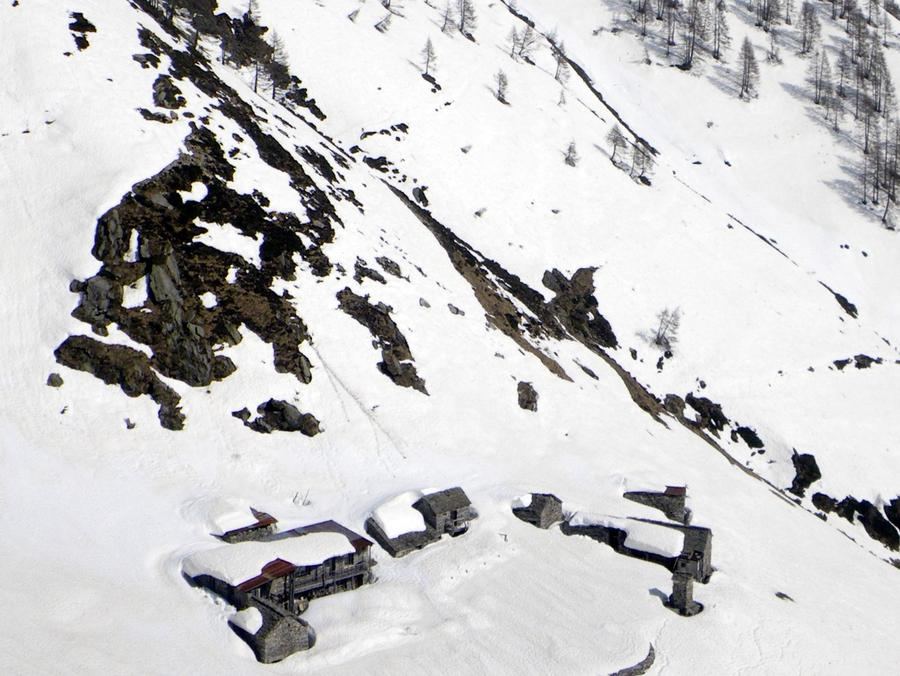
🇨🇭Switzerland · Ticino

Via Alta Vallemaggia

Multi-day hut-to-hut trek across Alpenverein huts
Via Alta Vallemaggia
Expert TraverseVia ferrata
Ozonski · CC BY 3.0
200 km
Distance
+16,000 m
Ascent
14 days
Duration
12
Huts
Best time: July – September
Check hut availability →
Download GPX ↓

About the route

Highest point
2,567 m
Huts on the route
12 × hut
Secured sections
Via ferrata K1-K3 · avoidable
Best time
July – September

The route at a glance

Elevation profile
↑ 17,062 m ascent↓ 16,829 m descent319 km2,701 m summit
20015002800Capanna Alpe Nimi · 1718 mRifugio Alpe Masnée · 2063 mRifugio Alpe Spluga · 1838 mCapanna Tomeo · 1880 mRifugio Alpe Fontana · 1651 mOstello Fusio · 1350 mCapanna Cristallina CAS · 2567 mRifugio Maria Luisa · 2157 mRifugio Pian di Crest · 2108 mCapanna Grossalp · 1730 mRifugio Ribia · 1800 mCapanna Alzasca CAS · 1735 m0 km64 km128 km191 km255 km319 km
Line colour = gradient (green gentle → red steep). Dots = huts. Route: © OpenStreetMap (ODbL), elevations from mapy.com.
Route mapOpen full map ↗

Plan and book

Live availability · Alpenverein

Pick a start date — for every night on the route you instantly see the free beds and book directly through the official Alpenverein system.


Choose start date
How many staying overnight
1
„free" = beds for the whole group
MonTueWedThuFriSatSun
All huts freePartly freeSelected
Start · arrival
Vogorno
◎ Plan arrival
Vogorno
Before the start · lodging
Stay overnight in Vogorno
Hotels and guesthouses in Vogorno · Booking.com
Booking.com →
1
Capanna Alpe Nimi
Day 1 · traverse to Capanna Alpe Nimi
↔ 19.9 km↑ 1130 m↓ 1623 m◷ 9–10 h

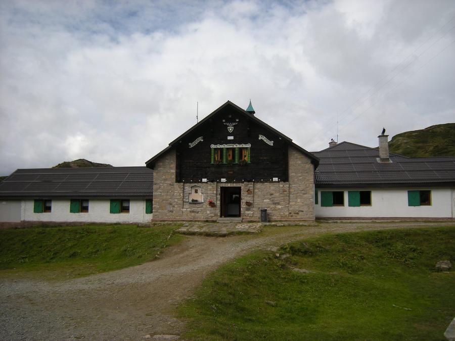
Start at Cimetta viewpoint above Locarno, accessed by cable car via Cardada — a balcony over Lago Maggiore. Night at Capanna Alpe Nimi (1,718 m).

2
Rifugio Alpe Masnée
Day 2 · traverse to Rifugio Alpe Masnée
↔ 17.6 km↑ 1187 m↓ 1475 m◷ 9–10 h

Ridges above the valley to Rifugio Alpe Masnée (2,063 m). Grass, scree, views into the Maggie valley.

3
Rifugio Alpe Spluga
Day 3 · traverse to Rifugio Alpe Spluga
↔ 5.7 km↑ 805 m↓ 402 m◷ 3–4 h

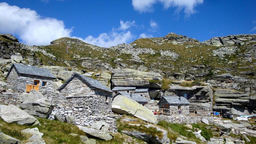
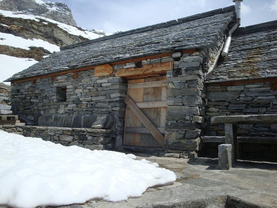
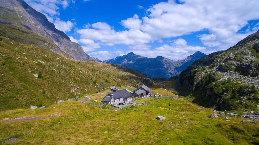
Traverse to Rifugio Alpe Spluga (1,838 m) via higher elevations with alpine landscape.

4
Capanna Tomeo
Day 4 · traverse to Capanna Tomeo
↔ 17.5 km↑ 887 m↓ 1442 m◷ 8–9 h

Through mountain pastures to Capanna Tomeo (1,739 m). Variants available from here.

Night 4
Hut info →Book →
5
Rifugio Alpe Fontana
Day 5 · traverse to Rifugio Alpe Fontana
↔ 2.9 km↑ 501 m↓ 131 m◷ 2–3 h

At Rifugio Alpe Fontana (1,651 m) you choose between east and west variants; east heads down to Fusio.

6
Ostello Fusio
Day 6 · traverse to Ostello Fusio
↔ 8.5 km↑ 736 m↓ 1101 m◷ 5–6 h

Descent to traditional mountain town Fusio (Ostello Fusio, 1,289 m) — the lowest point of the middle circuit.

Night 6
Hut info →Book →
7
Capanna Cristallina CAS
Day 7 · traverse to Capanna Cristallina CAS
↔ 13 km↑ 1697 m↓ 720 m◷ 8–9 h

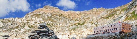
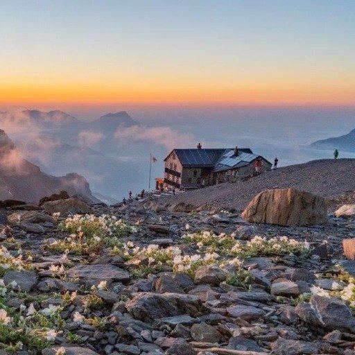
Climb to the trek's rooftop: Capanna Cristallina SAC at 2,575 m, a Swiss Alpine Club hut beneath Basòdino Glacier, the highest mountain and glacier of the Ticino Alps.

8
Rifugio Maria Luisa
Day 8 · traverse to Rifugio Maria Luisa
↔ 16.3 km↑ 1272 m↓ 1373 m◷ 8–9 h

Via Passo di Cristallina across the border into Italy to Rifugio Maria Luisa in Val Formazza, below Lago Toggia dam — springboard for Basòdino ascents.

9
Rifugio Pian di Crest
Day 9 · traverse to Rifugio Pian di Crest

Back via ridges to Rifugio Pian di Crest / Capanna Piano delle Creste (2,108 m). Views to distant peaks.

10
Capanna Grossalp
Day 10 · traverse to Capanna Grossalp

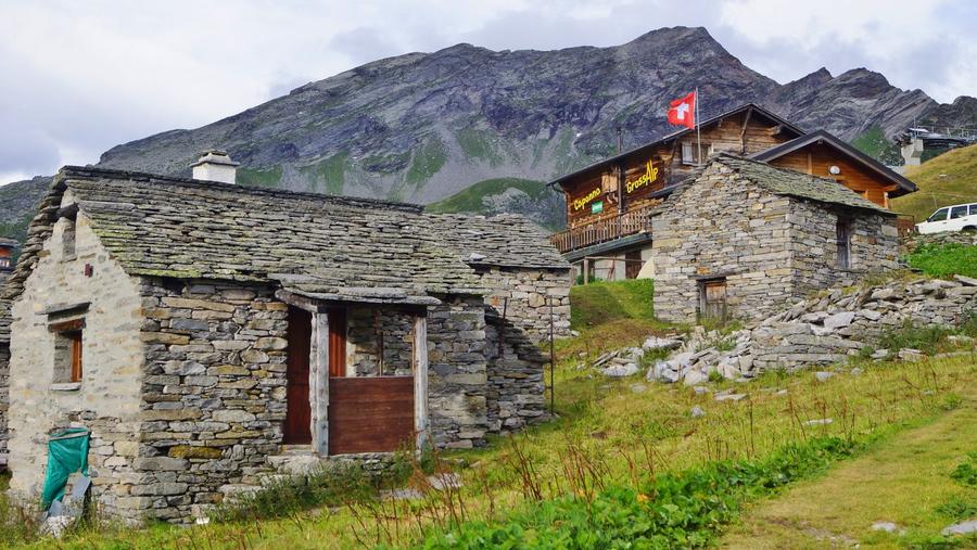
Descent from high elevations to Capanna Grossalp (1,906 m).

Night 10
Hut info →Book →
11
Day 11 · traverse to Cimalmotto
↔ 21 km↑ 1439 m↓ 1833 m◷ 11–12 h

Easier stage at lower elevations through Cimalmotto village (1,400 m).

Cimalmotto 1400 m
Valley village · lodging via Booking.com
Booking.com →
12
Rifugio Ribia
Day 12 · traverse to Rifugio Ribia

Through mountain pastures to Rifugio Ribia (1,996 m) on the Verzasca side of the circuit.

Night 12
Hut info →Book →
13
Capanna Alzasca CAS
Day 13 · traverse to Capanna Alzasca CAS

Capanna Alzasca SAC (1,734 m), a Swiss Alpine Club hut with views toward the Lepontine Alps.

Descent to the valley · Vogorno
The loop closes back at the starting village — approximate destination, lodging below.
Vogorno
After the trek · lodging
Stay an extra day in Vogorno
Hotels and guesthouses in Vogorno · Booking.com
Booking.com →
Route alert
Want the whole route on one date?
Leave your e-mail. We’ll write as soon as every hut on the route lines up with no gaps — with the dates straight to your calendar.

What to pack

Sleeping bag liner
Sleeping bag liner
Required in huts
Browse at 4camping →
Hiking boots
Hiking boots
Ankle-high, category B–C
Browse at 4camping →
Waterproof jacket
Waterproof jacket
Hardshell, 3-layer
Browse at 4camping →
Backpack 30–40 l
Backpack 30–40 l
Multi-day, with rain cover
Browse at 4camping →
Trekking poles
Trekking poles
Foldable
Browse at 4camping →
Headlamp
Headlamp
Rechargeable
Browse at 4camping →
Via ferrata set
Via ferrata set
Shock absorber + carabiners
Browse at 4camping →
Climbing helmet
Climbing helmet
Light, for via ferrata
Browse at 4camping →

Handy before you go

tips from verified partners
View on GetYourGuide
Partner · experiences
Tours and activities nearby
Guided tours, via ferratas and trips around Vogorno — book online.
View on GetYourGuide →
Get Revolut
Partner · payments
No foreign-currency fees
A card for fee-free payments and withdrawals along the whole route — exchange rate with no markup.
Get Revolut →
Buy an eSIM on Airalo
Partner · connectivity
eSIM data in the Alps
Mobile data without roaming for the whole trek, activated in a minute.
Buy an eSIM on Airalo →

Frequently asked questions

How long is Via Alta Vallemaggia and how much elevation gain?+
The route measures around 200 km and climbs roughly 16,000 m. Officially divided into 19 stages; in our planner we guide it as roughly a two-week circuit with hut-to-hut nights.
Where does the trek begin and end?+
Starts at Cimetta viewpoint above Locarno (accessible by cable car via Cardada) and ends at Ponte Brolla, the valley gateway where the Maggie meets the main river. The route circles the entire Vallemaggia valley.
How difficult is Via Alta Vallemaggia?+
Expert-level. Difficulty reaches T5− on the alpine scale. Red-white ridge trails (T3) alternate with blue-white alpine routes (T4–T5−); exposed sections have chains and steps. There are short passages with falling risk and climbing moves.
Who is this route suitable for?+
For seasoned alpinists with alpine confidence and fitness for two weeks above two thousand meters. Not for beginners or anyone uncomfortable with exposed terrain.
Which huts are on the route?+
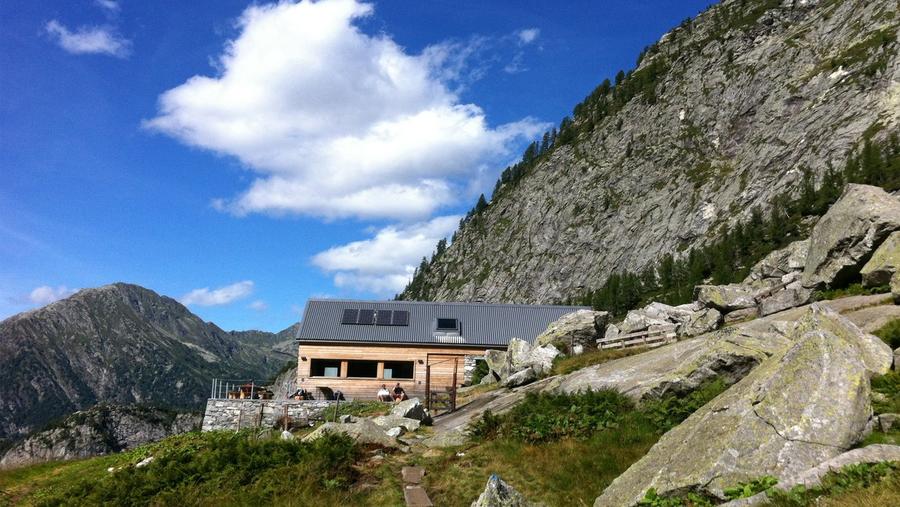
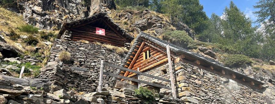
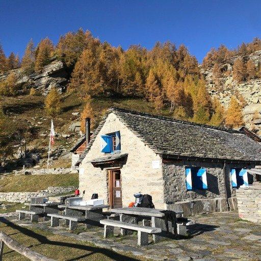
Among others: Capanna Alpe Nimi, Rifugio Alpe Masnée, Rifugio Alpe Spluga, Capanna Tomeo, Rifugio Alpe Fontana, Ostello Fusio, Capanna Cristallina SAC, Rifugio Maria Luisa (in Italy), Rifugio Pian di Crest, Capanna Grossalp, Rifugio Ribia and Capanna Alzasca SAC. Most are converted old pastoral buildings.
When is the best season?+
July through September, exceptionally October. Some huts open in June, but connecting stages often still lie under snow and freeze hard in the mornings, which is dangerous.
How do I book stays?+
In advance. SAC/CAS huts and private rifugios reserve ahead; the official viaaltavallemaggia.ch site has a portal to check availability. Without reservation you risk ending up without a bed.
Is there a via ferrata on the route?+
Classic via ferrata isn't on the main route, but exposed sections are secured by chains and steps. Terrain is alpine T4–T5−, not a via ferrata with full kit.
What is the highest point?+
Highest sleeping is at Capanna Cristallina SAC at 2,575 m. It sits beneath Basòdino Glacier, the highest mountain and glacier of the Ticino Alps, and at Passo di Cristallina where you can cross into Italy.
Does the route leave Switzerland?+
Yes. Via Passo di Cristallina you cross the border into Italy to Rifugio Maria Luisa, which sits in Val Formazza below Lago Toggia dam. Bring documents.
Can you do the route in sections?+
Yes. The circuit can be done as one go or by individual stages, since it officially divides into 19 sections and offers variants at several points (east/west at Alpe Fontana, northern branches around Cristallina).
Why is Via Alta Vallemaggia interesting?+
It's a circuit, not a transfer from A to B — it circles the entire Vallemaggia valley around its ridges. Development began with the idea in 2004, first section opened 2009, and the circuit closed with completion of Fusio–Ponte Brolla. It follows trails of ancient mountain herders.

Similar routes

Show all routes →
BärentrekModerate
Bärentrek
Bernese Alps
100 km6 days
Kesch TrekModerate
Kesch Trek
Graubünden
36 km4 days
Tour des MuveransHard
Tour des Muverans
Vaud / Valais Alps
60 km5 days